
Sentiers du Patrimoine ®
Cherence
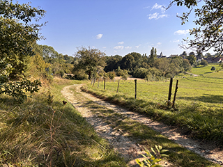
Poursuivre sur 700 m toujours tout droit jusqu’aux ruines du hameau de Bézu.
Prochain point : Lat. 49.0967, Long. 1.6664
Chérence occupies a distinctive location. The village lies at the edge of a plateau overlooking the Seine Valley and the national nature reserve. The chalk cliffs of the surrounding slopes form the southern boundary of the commune. The terrain of Chérence is hilly: to the north-east it is overlooked by the hill of Villers, while to the east it is cut by a ravine collecting the waters of the Aulnaye springs. The village nestles on both sides of this valley, which extends as far as the Epte. Water is abundant here and, in the early modern period, it was channelled to supply the château and the village of La Roche-Guyon via an aqueduct, remnants of which—stone inspection shafts— can still be seen in some fields.
The commune’s territory has been inhabited since Neolithic times: remains of early agricultural settlements have been discovered, and a former covered passage, now lost, was even reported in the 19th century at Bézu. Evidence of both Gaulish and Gallo-Roman presence has also been uncovered. The boundaries of Chérence have shifted over time: until 1670, Haute-Isle was part of the commune. Several former hamlets also disappeared over the centuries, including Cocriomont—likely largely troglodytic—by the 18th century, and Bézu in the north-west of the village, whose last inhabitants were recorded in the 1950s.