
Sentiers du Patrimoine ®
Oinville-sur-Montcient
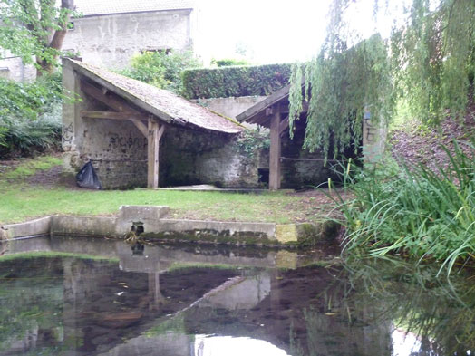
Lavoir de la Mathurine
Revenir sur le chemin et le descendre jusqu’en bas. Tourner à gauche pour rejoindre la mairie, puis emprunter l’escalier situé à sa gauche, à l’extrémité d’un bâtiment. En haut, tourner à droite pour rejoindre et traverser le lavoir de Gournay.
Prochain point : lat="49.02867" lon="1.852751"
This lavoir, or wash house, has a roof held up by wooden pillars, able to capture rain water. The roofing is therefore called the compluvium. The basin where the water is captured is called the impluvium. This kind of basin usually has a semi-circular, or rectangular shape, as is the case here. It is closed on three sides and has a single basin with washing stones on each side.
On the outskirts of the lavoir is an ancient watering hole, it was once used as a pool and fishing pond. At one time, both belonged to the estate of the first chateau of Oinville-sur-Montcient. The town also bears traces of individual lavoirs, located on the banks of the river.