
Sentiers du Patrimoine ®
Génicourt
Suivre le chemin qui vire à gauche et à la sortie du bois, emprunter à droite la sente de la mine d’or. Remonter à droite jusqu’à la ferme de Gérocourt.
Prochain point : lat : 49.103048, long. 2.056508
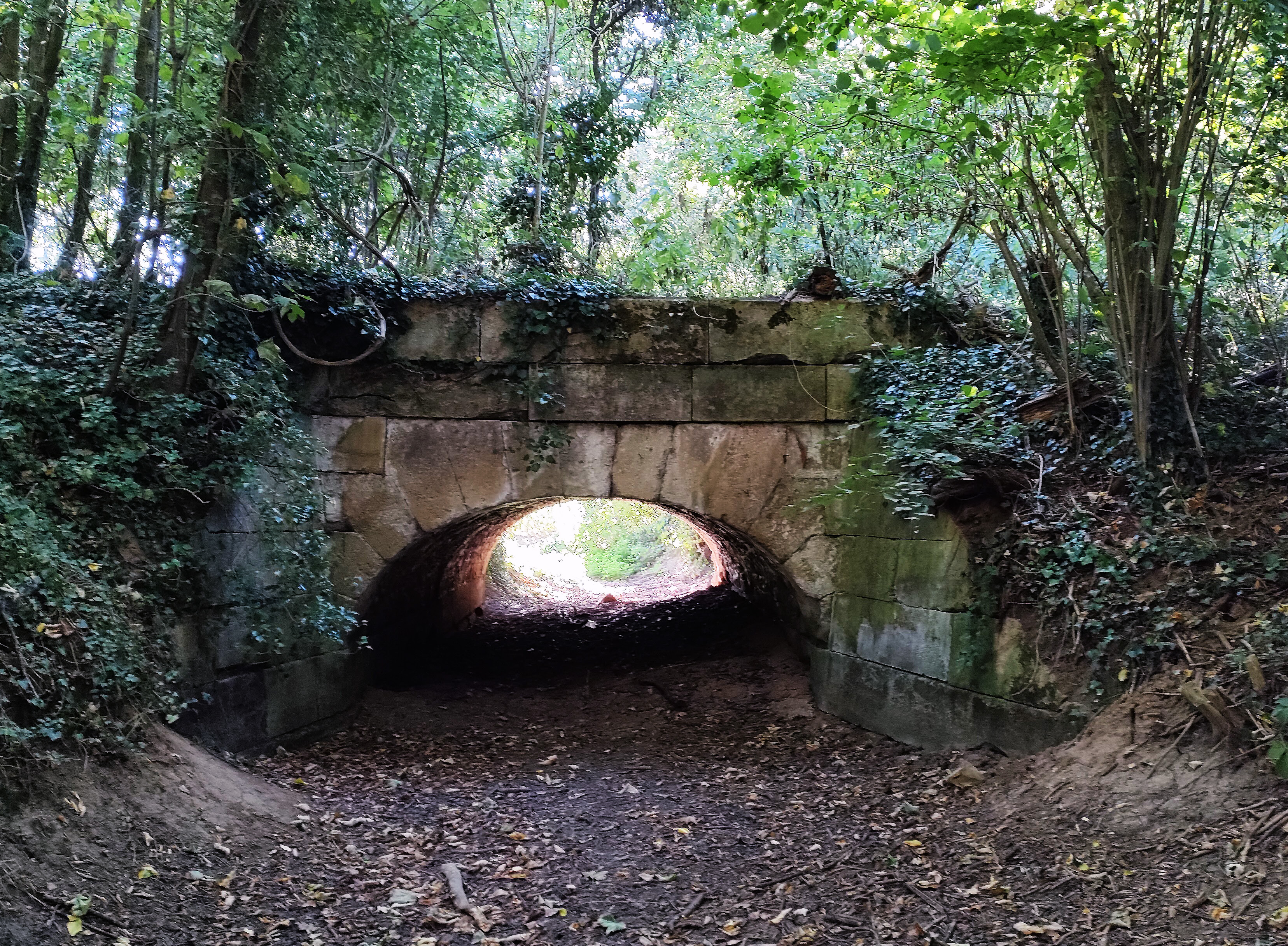
The Pont de l’Arche, or Pont du fond de l’Arche, enables you to cross what used to be a streamon the road between Génicourt and the hamlet of Gérocourt. This stone bridge is 8-meter long for 6-meterwide and is quite discreet in the undergrowthscenery. And yet it is a beautiful masonry work probably dating back to the 18th century which lays on a semicircular and segmental arch. It was made from dimension stones.
If this road is today a trail for pedestrians across the woods, it used to be the old main road linking Poissy to Beauvais via Pontoise. You can actually see it on Cassini’s map dating from the 18th century. This route is now used by the D22 but with a slight modification : the route is diverted at the level of Gérocourt and goes West of the hamlet rather than the East as it was the case before the Revolution. This modification probably led to the downgrading of this part of the road, now a pedestrian trail.