Informations directionnelles
Continuer en direction de l’Oise. Emprunter le chemin à gauche jusqu’au panneau sur les bords de l’Oise.
Prochain point : lat="49.13147" lon="2.2375"
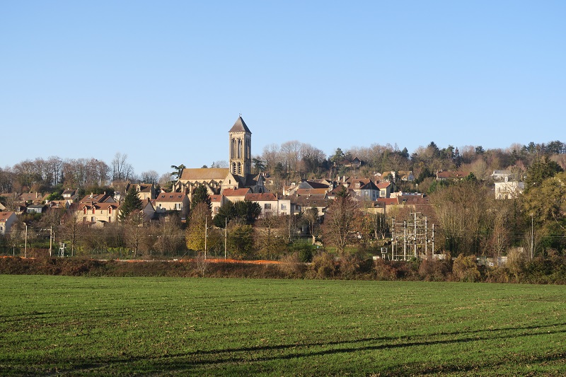
The banks of the Oise
Ile de Champagne, towpath
A river landscape…
The source of the Oise River is in the Bois de Bourlers, a forest near Chimay in Belgium. It runs for 341 kilometres and flows into the Seine at Conflans-Sainte-Honorine in the Yvelines region. The Oise is navigable across practically its entire length and has always been a buzzing hive of activity. There are several islands along the course of the river. Champagne island is around 520 metres long and 55 metres long and is wooded throughout. A few buildings have hung on at either end of the island. Towpaths were built over the centuries so boats could be towed along a river or canal by a rope – at one time pulled by hand or by horses. Nowadays Voies Navigables de France, the waterways authority, manages the towpaths and many of them have been transformed into walks.
…that inspires
The light and landscapes here have long drawn painters to the banks of the Oise. Charles-François Daubigny (1857-1878) and Vincent Van Gogh (1853-1890) painted at Auvers-sur-Oise, Camille Pissarro (1830-1903) set up his easel at Pontoise and Louis-Albert Demangeon (1909-1979) painted at Champagne-sur-Oise. Demangeon lived in Paris and was a frequent visitor to his house in Champagne, bought in 1912 from his grandfather, architect paul Wallon. He was a regular at the Salon des Indépendants, showing his work in the Salon exhibitions from 1937 to 1979. Demangeon drew his inspiration from the landscapes of the Oise valley – a passion shared with his friend and fellow-painter Robert Lepeltier (1913-1996), who also lived in Champagne.